Contents
Index
Read LandXML Parcel File
This option will read in a LandXML parcel file into the job.
The data will include polygon descriptions and point coordinates.
It may or may not have the dimensions of the parcel lines
Geocadastre will read this data, and if dimensions are missing it will calculate them from the coordinate values.
If the line dimensions have to be calculated, the following options are available:
(1) They can be rounded according to the local state regulations.
(2) If the coordinates are on a geodetic datum such as MGA, the distances will be computed as ground distances.
(3) The bearings can optionally be calculates as "True Mid Bearings"
General Procedure
In Liscad or Similar Software.
Generate the points for the lot corners using the usual cogo routines.
These coordinates can be on a local datum or they can be on a geodetic system such as MGA.
Generate a polygon for each parcel and put the lot number in the polygon name.
Export the job as an XML file.
In Liscad, export the job as an XML file for "Landxml Topcon Civilcad SEE Database".
In Geocadastre
Start a new job, set the datum, zone and job centroid.
If the data is using Geodetic coordinates, include the local height in the job centroid.
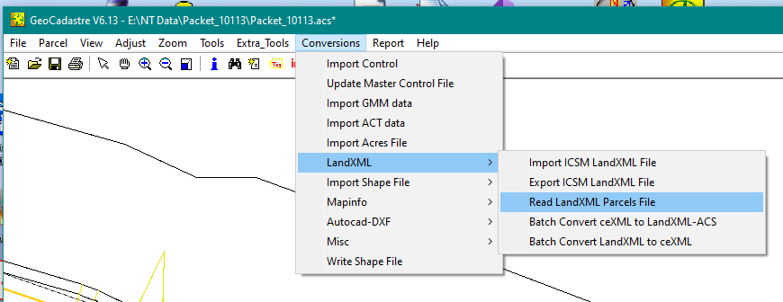
From the Conversions menu select "LandXML/Read LandXML Parcels File"
The following menu will be displayed
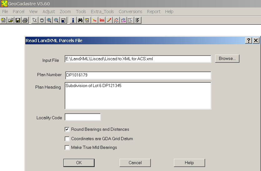
Enter the name of the file in the top window.
Enter the plan number, and the plan heading in their respective windows.
The locality code is an optional window only needed for Northern Territory data.
If you require the computed bearings and distances to be rounded, tick the "Round Bearings and Distances" box.
If the coordinates are on a geodetic datum and you require "True Mid Bearings" distances tick the "True Mid Bearings" box.
The file will be read in and parcels will be generated from the LandXML parcels data.